The Meon Survey Partnership offers a wide range of photography and photogrammetric services;
We can produce high quality rectified imagery from stitched together photographs, this can be used in conjunction with aerial imagery from drones/UAVs, cherry-picker or an extending pole to capture the upper parts of the building or structure.
Control would need to be established to provide base coordinates, once these are established the images can be stitched together and a rectified image produced from this.
Example images below;

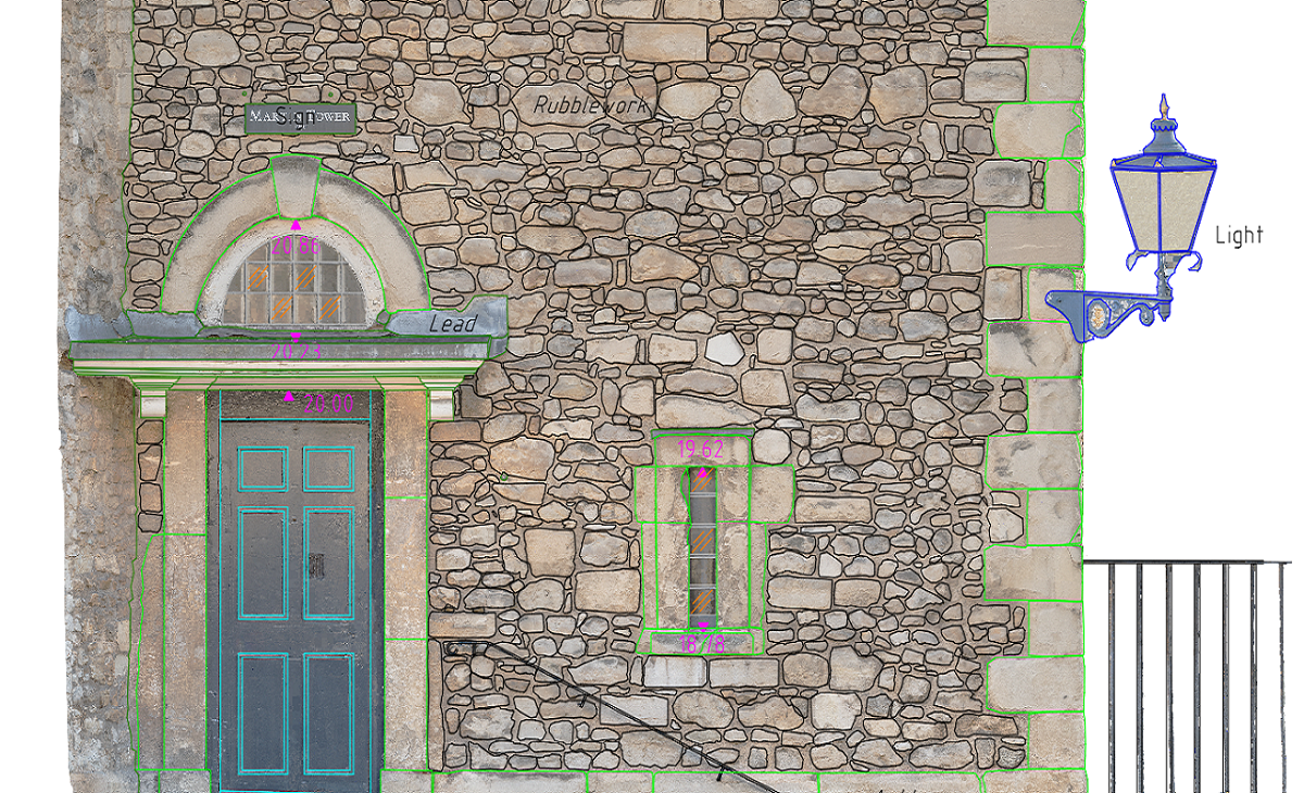
Control points were taken from a laser scan point cloud and the high resolution image was rectified to these control points. Linework was then added to the rectified photo.
Larger image

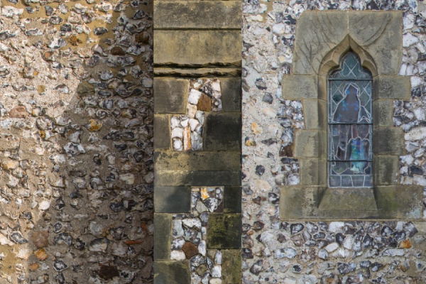
The above image consists of several images using a DSLR, each image was rectified on the correct plane and stitched together, control points were taken from an electronic total station.
Larger image

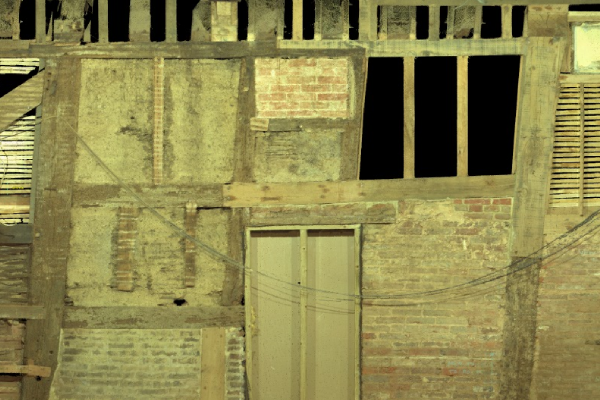
Created from a laser scanner, the wall was scanned in high definition and images from the scanner were applied to the point cloud, marginally reduced quality than from DSLR but faster.
Larger image
The example below is of Colston Hall in Bristol, this was created from hundreds of photographs from ground level and a cherry picker for the higher levels, these images were stitched together and tied to control points, the quality of the final product is staggering.
Click on the image below for a larger image.
The art of Photogrammetry dates back to the mid-19th Century and surveys were created using stereo plotters, modern day technology and software means that surveys can now be created using a combination of aerial and land photography quickly and efficiently.
The Meon Survey Partnership have the technology and skillsets to produce high quality 3D textured models using high quality photography and base measurements. We have high resolution camera equipment to produce 3D pointclouds and textured mesh models of large or small sites, difficult to reach areas and buildings which need high quality models, the methods can be combined with land based laser scanners to produce point cloud solutions or a mixture of ground and aerial photography for true colour representations. We have a few examples below but if need more information please do not hesitate to contact us.
Click on the images below and you'll be able to zoom in and rotate around the model, this can be exported to most 3D standards.
The textured model below was created using only 45 images from a high resolution DSLR, by zooming in on the sketchfab player below you can see there is already a substantial amount of detail, this can be increased by taking more images.
Control points are taken using either electronic theodolite or laser scanner and a point cloud is constructed, from this a coloured 3D mesh is created.
Drones (UAV) can be used to capture images or video footage of roofs, upper parts of buildings, bridges, quarries and other inaccessible or unsafe areas. Please take a look at our aerial survey web page for more information.
We can offer solutions to help with preparing Visually Verified Montages (VVM) or Acurate Visual Representations (AVR) whether supplying just the photographic views, the control points or a complete solution using our 3D modelling experience, The Meon Survey Partnership can help.
Share this page...
Please contact us if you require a quotation or any further information, we will be delighted to help!